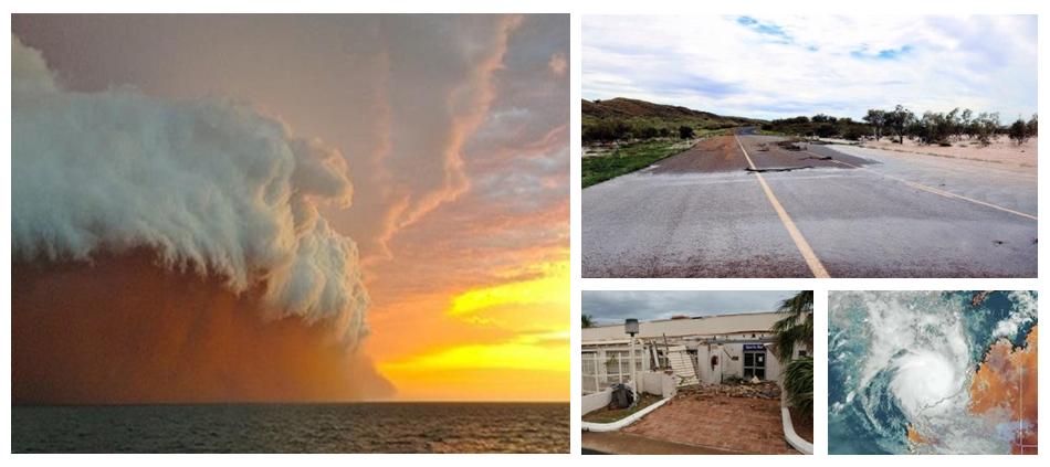
The Pilbara region shares both a tropical and semi desert climate, with temperatures ranging from 15°C to 45°C. From April to October, the West Pilbara Coast has the ideal weather and climate to spend your holidays, with winter daytime temperatures averaging around 25°C to 30°C.
The average monthly temperatures for Karratha and surrounds:
|
Month |
JAN | FEB | MAR | APR | MAY | JUN | JUL | AUG | SEPT | OCT | NOV | DEC |
|
Maximum °C |
38.2 |
38.3 |
37.1 |
34.7 |
29.9 |
26.6 |
26.2 |
28.5 |
32.2 |
34.8 |
37.7 |
38.7 |
|
Minimum °C |
26.1 |
26 |
25.1 |
21.8 |
18 |
14.8 |
13.2 |
14.2 |
16.6 |
19.1 |
22.5 |
24.6 |
Cyclones
 Located in the cyclone belt of North West Australia, weather conditions across the West Pilbara Coast can change quite noticeably from day to day, particularly in the summer. During the cyclone season from November to March, the region receives its annual rainfall between 254mm to 305mm per year. Severe cyclones can cause widespread damage, injury and loss of life. As cyclones often adopt an erratic course and can change speed suddenly, it is important to be aware of any changes by tuning into local radio and television broadcasts. There are four stages of alerts: Blue, Yellow, Red and All Clear.
Blue: A cyclone has formed and may affect the area within 48 hours. You need to start preparing for dangerous weather.
Yellow: A cyclone is moving closer to the area and appears inevitable. Ensure that all loose material and objects are safely stowed or secured.
Red: A cyclone is imminent. Make arrangements to be in your residence or shelter area when the cyclone arrives. Ensure to tune into the emergency broadcaster for Karratha and the surrounds on 702AM.
All Clear: The cyclone has passed the area but there may still be high winds and heavy rain. Venture outdoors with caution.
Where Can I Get More Information?
Check out the Bureau of Meteorology website or call 1300 659 210 (within Australia only) for detailed information about the weather and climate of Karratha and Australia’s West Pilbara Coast, cyclone warnings, emergency information and road conditions.
